An Okanagan student put her newly learned skills to work during a summer break trip which was cut short due to devastating wildfires.
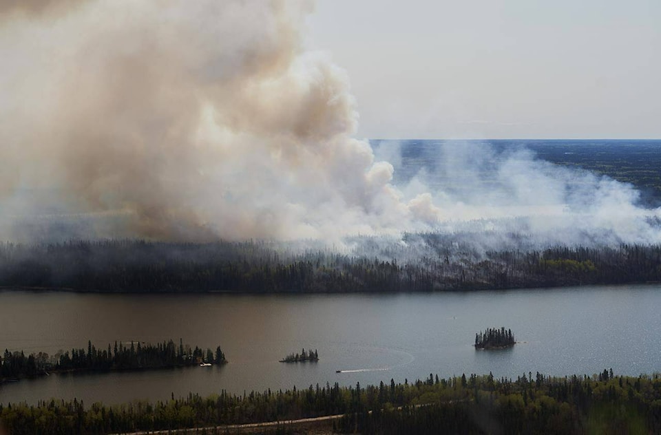
Third-year University of British Columbia Okanagan (UBCO) geography student Jenna Taylor visited her hometown of Flin Flon, Manitoba last month, just before the community was placed under a mandatory evacuation order due to spreading wildfires. With the fires affecting many communities across her home province and Saskatchewan, Taylor was inspired to help by developing an innovative wildfire emergency website.
Taylor used ArcGIS, a geospatial platform for mapping and sharing data, and the technical skills she gained through her coursework in geography and climate science, to transform the platform into a full emergency information space. The website offers interactive fire growth and weather maps, real-time data visualization and fire condition updates, resources for evacuees and ways to support affected communities.
Taylor launched the site to visualize the growth of the fires around her hometown and the surrounding areas after finding herself evacuated due to the rapid growth and devastation.
"Seeing the fire spread so quickly through an area that means so much to me has been overwhelming,�㽶��Ƶֱ��� she said. �㽶��Ƶֱ���I wanted to do something to visualize just how serious the situation was and to help others stay informed and connected during such a stressful time.�㽶��Ƶֱ���
Taylor started the website with a time-lapse map of the fire's growth over a one-week period, which she updated daily to reflect changes. The wildfire had spread over 515,000 hectares as of June 9, with small towns such as Denare Beach in Saskatchewan losing almost half of its homes. Taylor's main goal of the project was to bring awareness to the communities facing devastation from wildfires.
"Denare Beach is a neighbouring community to Flin Flon, which we all hold close to us," she said. "We are very thankful for the firefighters and essential services who have been helping the communities during this time.�㽶��Ƶֱ���
Taylor credits UBCO and its GEOG 270: Cartography and Map Making course, as the foundation for the website came from the skills she developed in the undergraduate course that focused on hands-on workshops in map creation, spatial data management and map-based communication. She said UBCO is at the "cutting edge of research" that helps to protect people, communities and infrastructure from wildfires.
She added that UBCO is a university that's at the forefront of the wildfire challenge, and studying there has inspired her to use her studies to make a difference in her community.
Jonathan Cinnamon, associate professor with UBCO�㽶��Ƶֱ���s Irving K. Barber Faculty of Arts and Social Sciences, said the course allows students to transfer skills and knowledge learned in the classroom to the real world.
"A perfect example is Taylor�㽶��Ƶֱ���s invaluable website, which contains up-to-date wildfire and weather maps to support decision-making in affected communities," he said.
Taylor also added that she hopes the site not only informs people but also encourages community action and resilience.
"Creating this platform allowed me to merge everything I�㽶��Ƶֱ���ve been learning with what I care about most�㽶��Ƶֱ���helping others and protecting the environment," she said.

